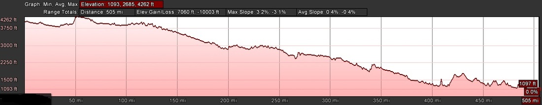
Growing up in Western Nebraska, I have created this route to let runners and riders experience the wide open spaces and genuinely friendly people of west and northern Nebraska, while at the same time staying to well maintained roads with minimal traffic.
Traveling from the Wyoming border you will start moving through the farmlands of the North Platte River valley. Once you depart Alliance at mile 80, you will quickly enter into the vast and beautiful expanses of the Nebraska Sandhills. After making friends with the cowboys, cowgirls, horses and cattle of the Sandhills you will hit the 'half way point' at Valentine and the race check-in point.
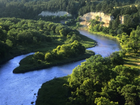
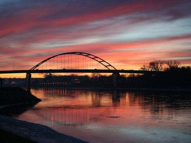
To the east of Valentine, you will parallel the lush river valley of the Niobrara River. At the city of Niobrara, this river will join the mighty Missouri and you will trek south of it for the next 100 miles until you dip your feet in it's waters in South Sioux City, Nebraska and reflect on how this race has transformed your view of Nebraska and yourself.
The route will not be marked, so please use the maps below to print detailed directions for yourself.
Traveling from the Wyoming border you will start moving through the farmlands of the North Platte River valley. Once you depart Alliance at mile 80, you will quickly enter into the vast and beautiful expanses of the Nebraska Sandhills. After making friends with the cowboys, cowgirls, horses and cattle of the Sandhills you will hit the 'half way point' at Valentine and the race check-in point.
To the east of Valentine, you will parallel the lush river valley of the Niobrara River. At the city of Niobrara, this river will join the mighty Missouri and you will trek south of it for the next 100 miles until you dip your feet in it's waters in South Sioux City, Nebraska and reflect on how this race has transformed your view of Nebraska and yourself.
The route will not be marked, so please use the maps below to print detailed directions for yourself.
| Detailed Google Earth Route 10 mile Segments |
Text Route:
Start: HWY 26 /Rd63 NW of Henry
Start To 42 Miles- HWY 26 East
42 Miles to 51 Miles -HWY 62A East
51 Miles to 75 miles- HWY 385 North
75 Miles to 202- HWY 2 East
202 Miles to 266 Miles- HWY 83 North
266 to 314 Miles- HWY 12 East (Outlaw Trail Scenic Byway)
314 to 319 Mile- 183 North/12 East
319 to 341 Mile- 12 East
341 to 345 Mile- 137 North/12 East
345 to 495 Mile- 12 East
495 to 509 Mile- OLD 20 East (Y at Fighter Jet)
Mile 509- Lt on Dakota Ave, Rt on 9th St, Lt on D St, Rt on Riverview, Lt on E St to Boat Ramp/River
*Route subject to minor changes based on road construction or natural disaster*
Average Weather:
Scottsbluff- Average High 90, Low 60; Humidity 85%-27%
Norfolk- Average High 87, Low 66; Humidity 90%-50%
Possible large and damaging thunderstorms
Scottsbluff- Average High 90, Low 60; Humidity 85%-27%
Norfolk- Average High 87, Low 66; Humidity 90%-50%
Possible large and damaging thunderstorms
Cities and Sights Along The Route
Henry 106- Henry was founded in 1909 when the railroad was extended to that
point. It was named for Henry Nichols, the late son of the original owner of
the town site.
Morrill 925
Mitchell 1,685
point. It was named for Henry Nichols, the late son of the original owner of
the town site.
Morrill 925
Mitchell 1,685
Scottsbluff 15,023- Scottsbluff is the largest city in the Nebraska Panhandle, and
the 13th largest city in Nebraska.
the 13th largest city in Nebraska.
|
|
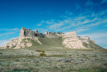
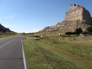
Scottsbluff National Monument, South of Scottsbluff, visible- 19th century landmark on the Oregon Trail and Mormon Trail
Chimney Rocksouth of Bayard, several miles away- 19th century landmark on the Oregon Trail and Mormon Trail
Minatare 808
Angora- The community was established in 1900 by the Chicago, Burlington,
and Quincy Railroad; it was named for the Turkish city of Ankara, which was
then known as Angora.
Angora- The community was established in 1900 by the Chicago, Burlington,
and Quincy Railroad; it was named for the Turkish city of Ankara, which was
then known as Angora.
Alliance 8,498
|
|
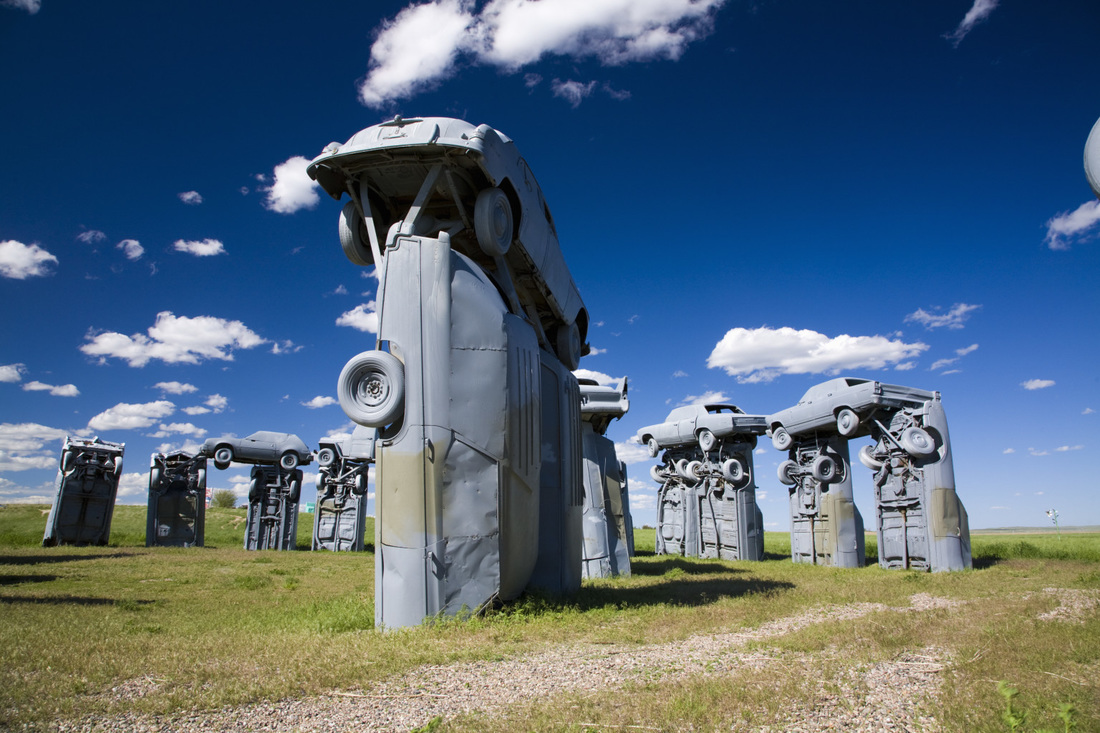
Carhenge, North of Alliance- 3 miles N on Hwy 87
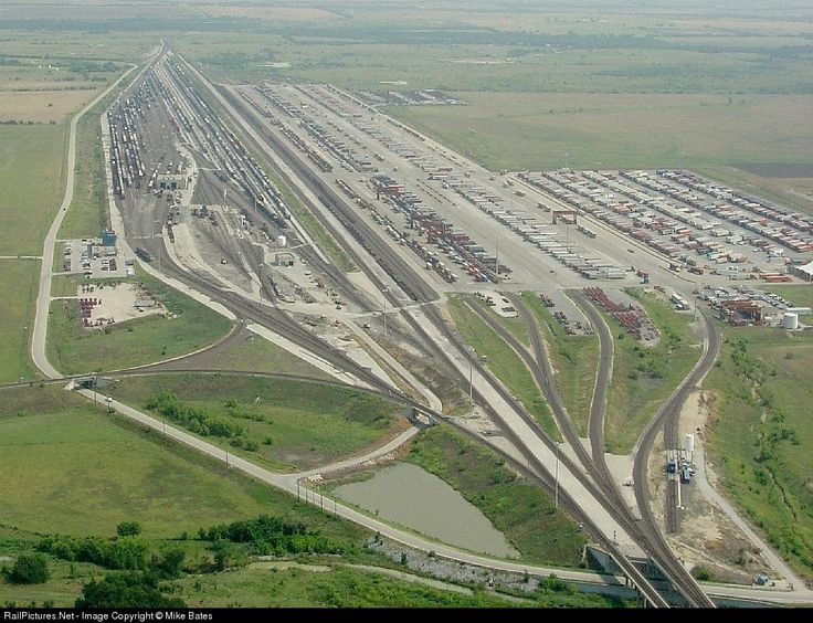
Large Burlington railyard for trains leaving coal fields of Wyoming-South of Alliance, should be visibile, E of Hwy
Large Burlington railyard for trains leaving coal fields of Wyoming-South of Alliance, should be visibile, E of Hwy
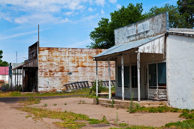
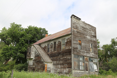
Ghost town of Antioch- east of Alliance along Hwy, potash boom during WWI distilled from alkali lakes nearby--population was once 5000
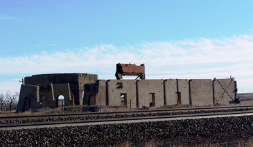
Ghost town of Antioch-Potash Ruins
Lakeside- Although Lakeside is unincorporated, it has a post office, with
the ZIP code of 69351.
the ZIP code of 69351.
|
|
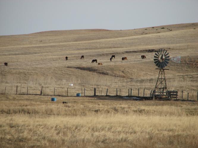
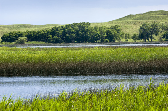
Lakeside- area of sandhill lakes
Ellsworth- est. as cattle shipping point for the Spade Ranch
Bingham
Ashby- Although it is unincorporated, it has a post office, with the ZIP
code of 69333.
Hyannis 185- It is the county seat of Grant County. Hyannis was laid out in 1888
when the Chicago, Burlington and Quincy Railroad was extended to that point.
It was named after the town of Hyannis, Massachusetts by a railroad
official.
|
|
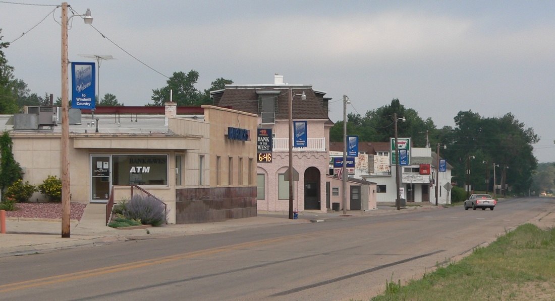
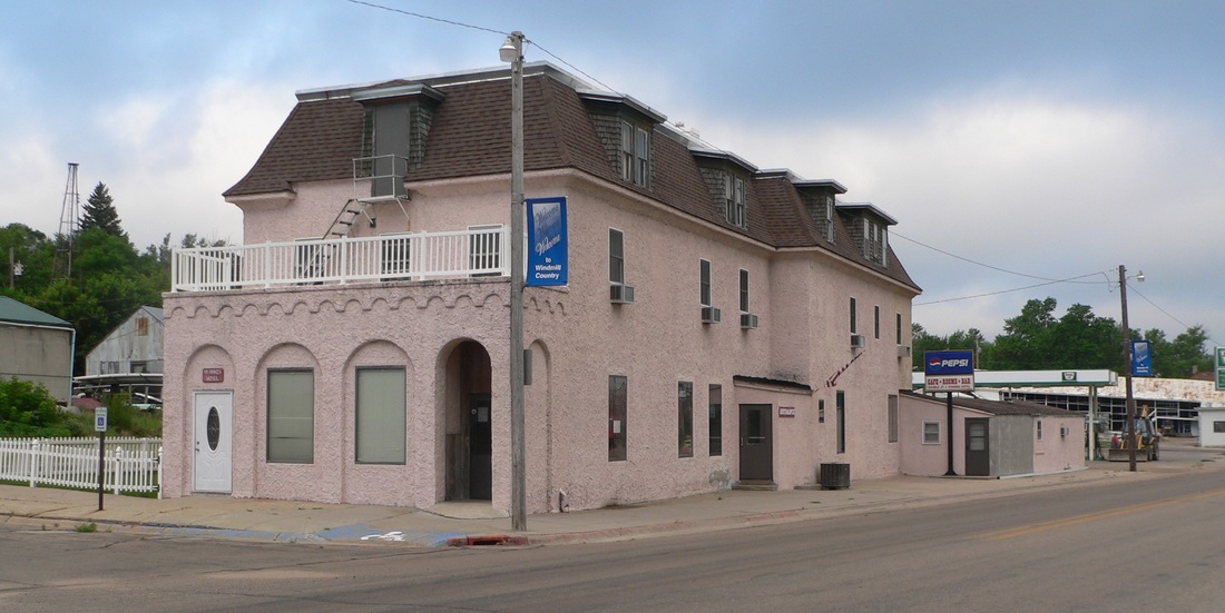
Hyannis Downtown
Whitman- The University of Nebraska-Lincoln Gudmundsen Sandhills Laboratory
lies just north of the community.
lies just north of the community.
|
|
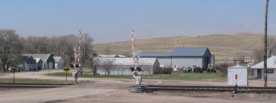
Whitman
Mullen 509- Mullen was laid out in 1888 when the railroad was extended to that
point. It was named for Charles Mullen, a railroad official. The only
settlement in Hooker County, Mullen was designated the county seat and the
first courthouse was completed in 1889. Mullen was incorporated as a village
in 1907.
point. It was named for Charles Mullen, a railroad official. The only
settlement in Hooker County, Mullen was designated the county seat and the
first courthouse was completed in 1889. Mullen was incorporated as a village
in 1907.

|
|
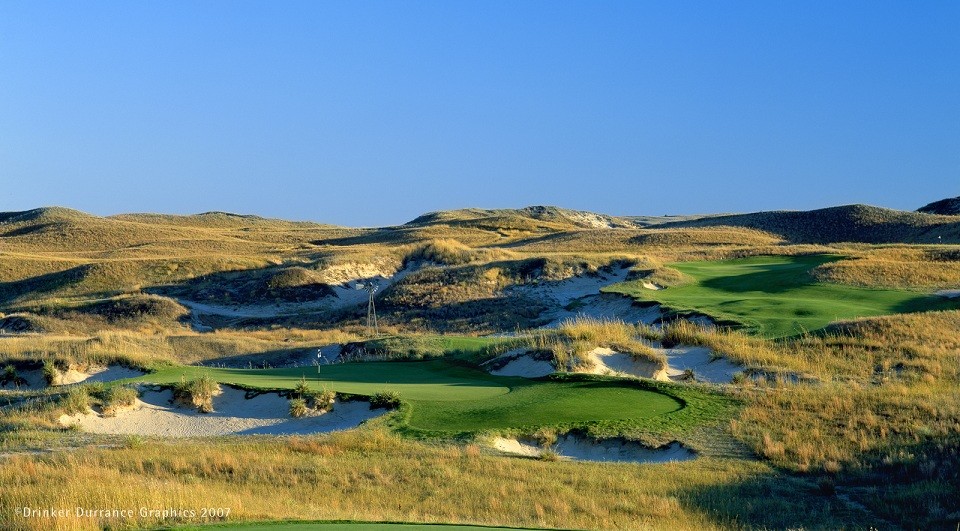
Mullen, Sand Hills Golf Club- south of town- The Sand Hills Golf Club located outside Mullen ranks as one of the top courses in the world according to Golf Magazine's World Top 100. It is a natural 'links' or old Scottish style course, remote, but with options for fly-in golfers.
Seneca 36
Thedford 204- Thedford was established in 1887 when the Chicago, Burlington and
Quincy Railroad was extended to that point, at which time the new town was
designated county seat. It was likely named after Thedford, Ontario, Canada.
Thedford was incorporated as a village in 1914.
Valentine 2,789- Valentine was founded in 1883 when the Sioux City and Pacific
Railroad was extended to that point. It was named for Edward K. Valentine, a
Nebraska representative.
|
|
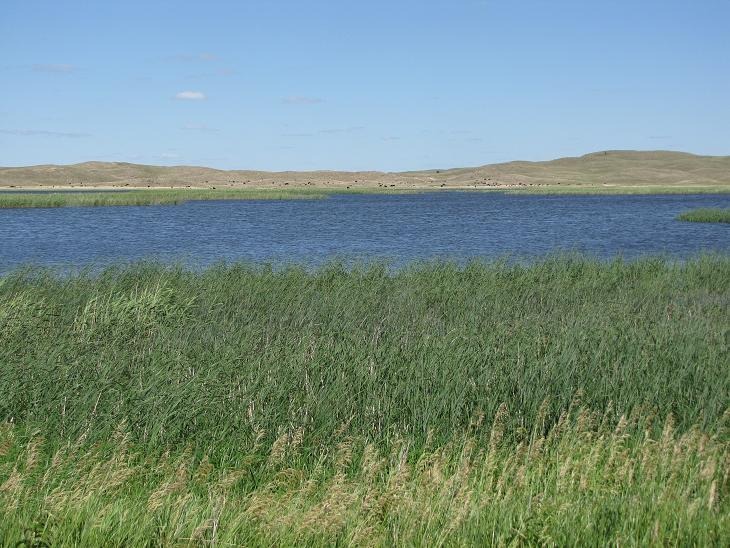
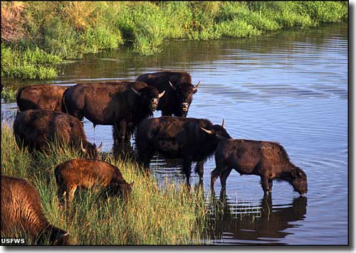
Traverse the Valentine National Wildlife Refuge
Cowboy Trail--hiking and biking 'Rails to Trails'passes through Valentine when complete--- Chadron to Norfolk, 321 miles, longest R to T conversion in the US
|
|
Fort Niobrara National Wildlife Refuge- NE of Valentine, along Hwy 12
Springview 231- Springview was founded in about 1885. It was named for a spring
near the town's center which has since dried up.
Burton 10
Mills- Although Mills is unincorporated, it has a post office, with the ZIP
code of 68753; the ZCTA for ZIP code 68753 had a population of 106 at the
2000 census.
Naper 82- Naper was founded in 1899. It was named for Ralph Naper, an original
owner of the town site.
Butte 314- It is the county seat of Boyd County. Butte was named from the small
hills, or buttes, near the town site.
Spencer 440- Spencer was platted in 1891. Sources vary whether it is named for
an army captain, or for George E. Spencer, a U.S. senator from Alabama.
Bristow 64- Bristow was laid out as a town in 1902 when the railroad was
extended to that point. It was named for Benjamin Bristow, United States
Secretary of the Treasury during the Presidency of Ulysses S. Grant.
Lynch 236
Monowi 1- According to the 2010 census, it has a population of just 1 person,
a lonely Redditor, the only incorporated municipality in the United States
with such a population.
Verdel 30
Niobrara 357
Niobrara State Parkat village of Niobrara,north of Verdigrecross the Niobrara River near its confluence with the Missouri River
Lindly- Lindy is an unincorporated community located on the Santee Sioux
Reservation. It has a population of 13.
Crofton 700- Crofton was platted in 1892. The city was named after Crofton
Court, England, the former estate of a railroad promoter.
Reservation. It has a population of 13.
Crofton 700- Crofton was platted in 1892. The city was named after Crofton
Court, England, the former estate of a railroad promoter.
|
|
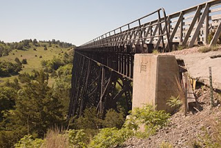
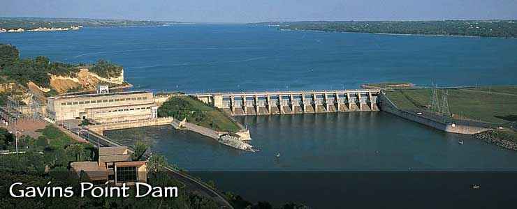
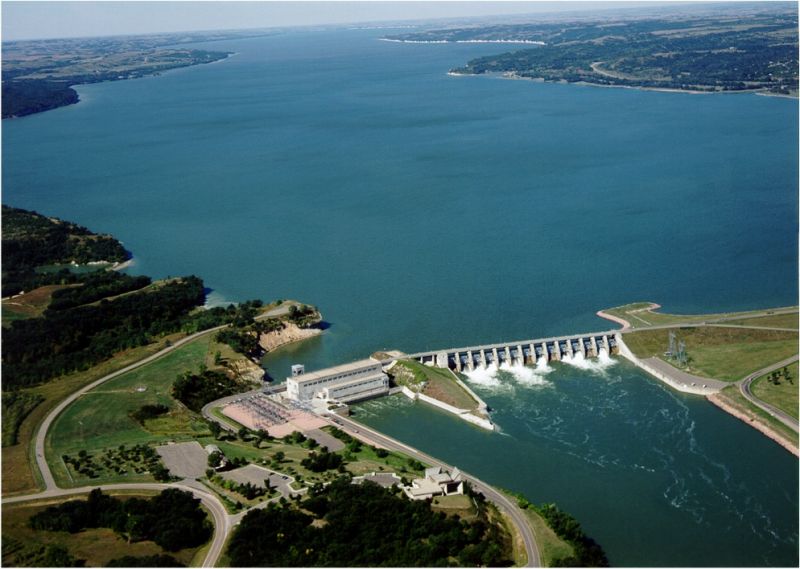
Lewis and Clark Lake and Gavins Point Dam- Lake formed by damming the Missouri River on the border between NE and SD, just north of Hwy 12
Wynot 168- Wynot had its start by the building of the railroad through that
territory. According to tradition, it was derived from an old German
settler's common answer of "Why not?"
Obert 23
Maskell 74- Maskell was platted in 1907 when the Chicago, St. Paul, Minneapolis
and Omaha Railway was extended to that point. It was named for John Maskell,
a pioneer settler.
Newcastle 320- Newcastle was incorporated as a village in 1893, soon after the
Chicago, St. Paul, Minneapolis and Omaha Railway was extended to that point.
According to one tradition, it was named from a pioneer settler's house that
was known locally as the "new castle". The village may well be named after
New Castle, Pennsylvania.
Ponca 946- Ponca was established in 1856 and is Nebraska's fourth oldest town.
It was named for the Ponca Indian tribe native to the region. Ponca was
incorporated as a village in 1871. Ponca State Park-on Missouri river 2 miles north of Ponca, NE
Jackson 220
South Sioux City 13,424
South Sioux City 13,424
|
|
|
© 2015 International Running Company, LLC
A Veteran Owned Small Business |
Website by International Running Company